Monday, May 09, 2016


Saturday, January 02, 2016
Escape to Brecon beacons
I couldn't agree more Michael McIntyre that the last week of the year is the most confused one. You don't know what day it is, you don't know what is expected from you, this week and if you are in UK you obviously don't know how the weather gonna be. Although all the above were true, we actually knew one thing for sure, an escape definitely on the cards. After some deliberation and debate over location we found our escape: Talybont-on-usk, a small village near the bank of River Usk in South Wales. A small quiet village with loads of walks did fit our bill. So we packed our bags and started our journey...
Travel to Talybont-on-Usk
Its ages since I wrote a travelogue. Hence let me say things have changed. "Us" now means its me and my wife along with others! and now in this land I can drive hence, the choices of escape has improved. Its nearly 2.5-3 hrs. drive to South Wales from Caversham. It was on Boxing day and we set off bit late in the day and found relatively empty M4. We took the toll road, and went straight to Wales. A40 to Usk valley was quite scenic.
Talybont-on-usk
 |
| Malt house in Talybont-on-Usk |
 |
| Loft room in this 1820 built house |
We had booked a family run B&B accommodation, Malt house in Talybont. Its a nice place, and river Caerfanell flows almost through the property, we could hear noise from the flowing river sleeping on the cosy bed. Weather on this part of UK during winter is quite unpredictable and we had prepared ourselves to the fact that we might have to stay indoor for few days. However to our surprise it wasn't that bad when we arrived in Talybont-on-Usk in the afternoon.
 |
| Remains of 200 years old Tramroad |
Its a village with loads of activities: few pubs, one river, one old Canal and several bike and walking routes and with some rich history. One particularly interested me, the history of tramways and the train road around the the valley, none of them are there at present but their existences are wrapped around the village. Tramways ran before 1850s, as popularity of the train grew, the tram line came to an halt in the second half of the 19th century, the train line experienced the same fate in the second half of 20th century when running train services in that part of Wales became non profitable! The waterway canal is also very old and heard stories about breaches once in a while, still its a tourist attraction and probably that is still keeping it alive.
The walk
 |
| Walking route (map here) |
 |
| Valley from Binnore Tramroad |
 |
| Valley from the reservoir |
 |
| Talybont reservior |
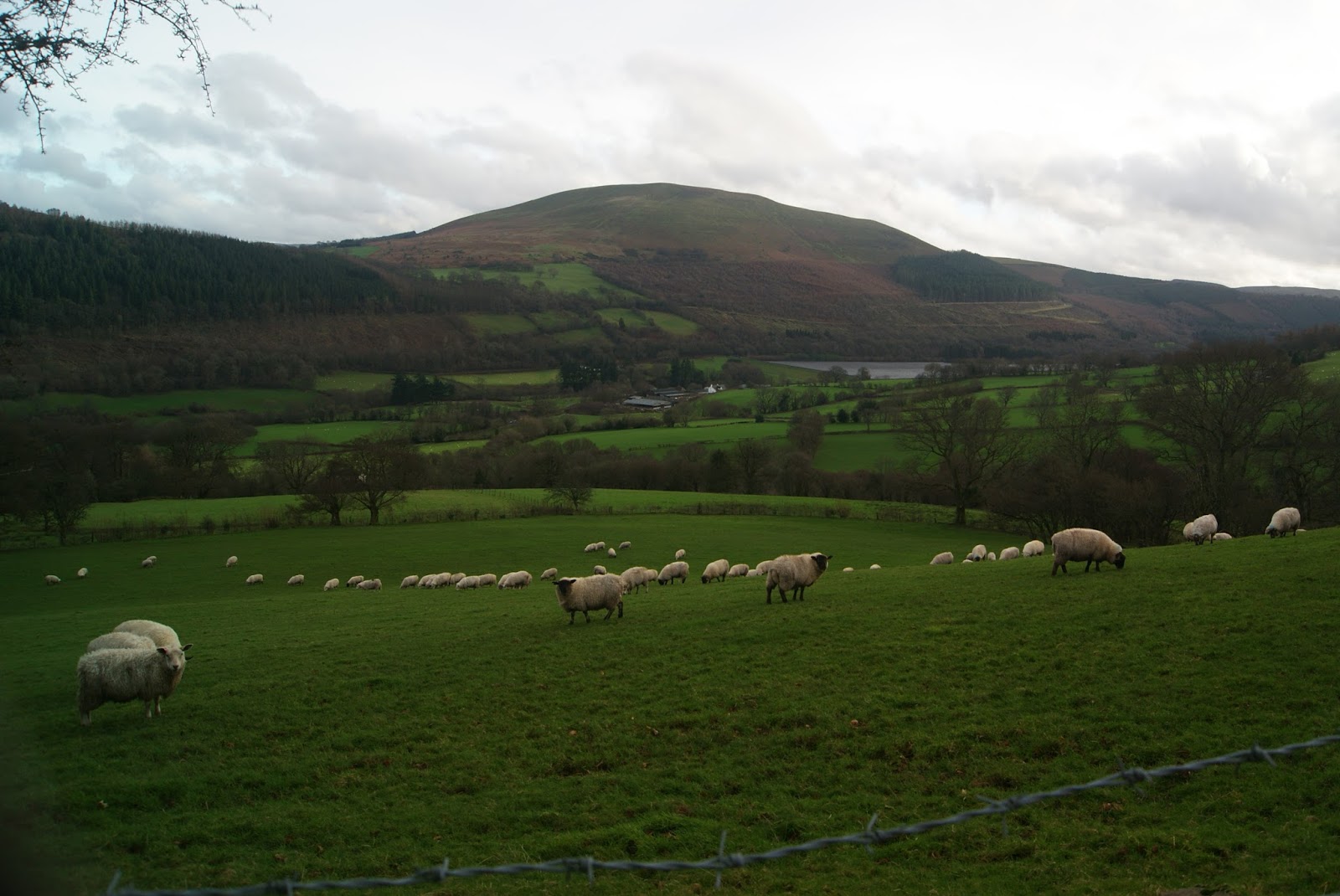 the walking bit challenging, but the trail was beautiful. We had to cross couple of small stream and Clydach. Eventually the trail lead us to another road inside the woods, we got to see a glimpse of Brecon's forest if not a full fledged forest walk. We wanted to complete the MTB trail, however it was already getting darker, even a sunny day couldn't be stretched beyond 16:00 . So we decided to the head back to Talybont through the farms. This stretch of the walk presented a different landscape. Fading sun brightening up before setting washed the valley and painted it golden, rain soaked valley was soaking the sun, we too, it was blissful! Although farm animals didn't particularly enjoyed our alien chorus songs, we loved their presence. It was time to call the best walk of the year a day. We walked back to Talybont crossing the Canal and back to our hotel. The complete walk, with breaks took us around 4 hours and it was nearly 7.5 miles.
 Food
 Although few, pubs in Talybont are quite well known. On the first evening we had food in the All star inn, appeared to be quite a popular place among the locals. Food was almost home cooked, fresh and tasty with very friendly staff. We had supper in white hart inn the next day. Food was as good as the all star. We dont know it was especially for that specific day, we were told the kitchen would close at 19:30. Price in both places were similar and we felt pretty reasonable.
Description of wonderful food wouldn't be complete if I dont mention the awesome breakfast that we had in the Malthouse. Heavy English breakfast with fresh juices, eggs and Honey from the farm, you cant ask for more. Thanks Mike for that.
Way back
Storm Frank had hit the shore in the night and the only option for us was to head back to Caversham. Although I thought drive through treacherous roads wont be nice but wasn't that bad. Because they were mostly empty untill we hit M4.

we ended the year filled with tranquillity, it was a trip worth making and would love to come back to one of the breathing space of Britain
Monday, October 31, 2011
Sweet n Sour egg delight
Ingredients:
1. Egg-3 nos
2. Onion-1 no
3. Ginger-chopped
4. Garlic- chopped
5. Bell pepper-1 no.
6. Oil- 1 1/2 tbsp
Sauce:
1. Tomato ketchup
2. Fruit juice (sweet, eg. pineapple, mixed fruit)
3. Sugar- 2 tbsp
4. Salt- to taste
5. pepper- 1/2 tbsp
6. chilli sauce - 1tbsp
7. Vinegar- 1 tbsp
8. Cornflour- 2 tbsp
Method:
1.Add chopped ginger and salt to the egg, beat the mixture. Add 1/2 tbsp of oil in a frying pan, and fry the egg, make square pieces.
2. Add 1 tbsp of oil on a pan, add chopped ginger and chopped garlic and fry for 2 min, cut the onion into square shape and fry
3. Add tomato ketchup in a separate vessel and add the fruit juice to it mix them and pour in to the pan when the onions are slightly fried. increase the flame.
4. Add warm water, chilli sauce, pepper, salt and sugar and let it cook for few mins
5. Add bell pepper and cook for 8-10 mins in low flame.
6. Add the egg pieces into the sauce
7. add Cornflour into water and mix, add the mix to the sauce to make it thick
8. add vinegar and stir for a min.
check the sweet and sour taste before taking it out of the pan.
Your sweet n sour Egg delight is now ready to be served
Sunday, October 30, 2011
Mushroom Peas curry
Ingredients:
Onion- 1 no. medium size
Ginger garlic paste- 1.5 tbsp
Tomato- 2 nos. medium size or Tomato Puree
Green Chilli: 2 nos.
Mushroom:250 gms.
Peas- 1 teacup
Curd/Cream: 2 tbsp
Jeera (whole):2 tsp
Garam masala(Whole)[optional]
Garam Masala powder
Dhone powder
Chilli powder
Turmeric
Oil: 1 tbsp
Method:
1.Wash the mushrooms in warm water and cut it into large pieces.
2. Heat oil, add the gram masala and jeera and fry, until the jeera turns brown.
3. Add onion, fry in high flame for 2 mins.
4. Add the ginger garlic paste.
5. Fry the whole thing till it turns golden brown
6. Add salt, tomatoes, green chillies.
7. Stir them in reduced flame till the tomato becomes pulpy.
8. Add tomato puree according to taste.
9. Add dhone, jeera, chilli, turmeric and garam masala powder.
10. Add the curd/cream and mix properly.
11. Add the mushrooms, mix them well, cover the vessel with lid.
12. Let it cook in the low flame for 5-10 mins.
13. Add the peas and mix.
14. Cook in a covered vessel till water dries up sparingly and the mushrooms become dark brown.
15. Put off the flame after the consistency as desired by you is achieved.
Tip: Don't add extra water; the mushroom will get cooked in its own water.
Onion- 1 no. medium size
Ginger garlic paste- 1.5 tbsp
Tomato- 2 nos. medium size or Tomato Puree
Green Chilli: 2 nos.
Mushroom:250 gms.
Peas- 1 teacup
Curd/Cream: 2 tbsp
Jeera (whole):2 tsp
Garam masala(Whole)[optional]
Garam Masala powder
Dhone powder
Chilli powder
Turmeric
Oil: 1 tbsp
Method:
1.Wash the mushrooms in warm water and cut it into large pieces.
2. Heat oil, add the gram masala and jeera and fry, until the jeera turns brown.
3. Add onion, fry in high flame for 2 mins.
4. Add the ginger garlic paste.
5. Fry the whole thing till it turns golden brown
6. Add salt, tomatoes, green chillies.
7. Stir them in reduced flame till the tomato becomes pulpy.
8. Add tomato puree according to taste.
9. Add dhone, jeera, chilli, turmeric and garam masala powder.
10. Add the curd/cream and mix properly.
11. Add the mushrooms, mix them well, cover the vessel with lid.
12. Let it cook in the low flame for 5-10 mins.
13. Add the peas and mix.
14. Cook in a covered vessel till water dries up sparingly and the mushrooms become dark brown.
15. Put off the flame after the consistency as desired by you is achieved.
Tip: Don't add extra water; the mushroom will get cooked in its own water.
Indian Green Chicken
Time to change the taste! I am writing my first post on recipe. Adding another label to the blog post (as if it was less).
Indian Green Chicken is actually a Indian curry dish made using spinach
Ingredients:
Chicken (boneless) 400 gmsPalak/Spinach 250 gmsOnion 2nos. medium sizeGinger garlic paste 2tbspTomato 2nos. medium sizeGreen Chilli 1 no.Oil 1 tbsp
For marination:
Lime juice 1/2 tbspCurd 2 tbspPepper & Salt to tasteRed chilli powder- 1pinch
Spices:
Whole garam masalaBay leaf 1 no.Coriander powder 1/2 tbspCumin powder 1/2 tbsp Turmeric powder 1/2 tbspGaram masala powder 1 pinch
Method
Boil palak in 4 cups of water, till it turns soft & green.2.Drain the water and blend the palak to form a thick paste.3. Marinate the chicken for 10-15 mins.4. Put the marinated chicken into the microwave for 3 mins (High power)5. Stir it and again heat it in the microwave for 5 mins.6. Heat oil in a vessel, add whole garam masala and bayleaf.7. Add the chopped onion, fry it for 2 mins.8. Add ginger garlic paste.9. Fry it till the onion turns brown.10. Add chopped tomatoes and the green chillies.11. Stir it for 3 mins.12. Add salt and other spices.13. Stir it till the tomato becomes pulpy.14. Add the chicken stalk and boil it for 1 min.15. Add the palak paste and boil it for 5-7 mins.16. Add the chicken and cook till the desired gravy consistency is achieved.
Tip: Instead of curd, vinegar can be used for marination
Indian Green Chicken is actually a Indian curry dish made using spinach
Ingredients:
Chicken (boneless) 400 gmsPalak/Spinach 250 gmsOnion 2nos. medium sizeGinger garlic paste 2tbspTomato 2nos. medium sizeGreen Chilli 1 no.Oil 1 tbsp
For marination:
Lime juice 1/2 tbspCurd 2 tbspPepper & Salt to tasteRed chilli powder- 1pinch
Spices:
Whole garam masalaBay leaf 1 no.Coriander powder 1/2 tbspCumin powder 1/2 tbsp Turmeric powder 1/2 tbspGaram masala powder 1 pinch
Method
Boil palak in 4 cups of water, till it turns soft & green.2.Drain the water and blend the palak to form a thick paste.3. Marinate the chicken for 10-15 mins.4. Put the marinated chicken into the microwave for 3 mins (High power)5. Stir it and again heat it in the microwave for 5 mins.6. Heat oil in a vessel, add whole garam masala and bayleaf.7. Add the chopped onion, fry it for 2 mins.8. Add ginger garlic paste.9. Fry it till the onion turns brown.10. Add chopped tomatoes and the green chillies.11. Stir it for 3 mins.12. Add salt and other spices.13. Stir it till the tomato becomes pulpy.14. Add the chicken stalk and boil it for 1 min.15. Add the palak paste and boil it for 5-7 mins.16. Add the chicken and cook till the desired gravy consistency is achieved.
Tip: Instead of curd, vinegar can be used for marination
Monday, September 27, 2010
Denude
 Surreal thoughts knocked the door that night,
realizations had struck like a lightning in a stormy night,
earth shivered
and the last…
lasted longer
and that night too.
The dew drops touched the bare skin that morning,
only if it could respond…
quivering lips parted to speak,
silence told the untold story
words dried, long back…
the last …
lasted longer
dancing flowers painted the horizon…
hope…
it did exist
bright sun soaked the torso,
bathing was warm..
warmth no longer came through the fingers…
they were folded…..and never opened again…long back
last, did last, quite long….
“Godhuli belar sese”
Solitary reaper sang the melancholy song
on her way back home…
home…lost in the lush meadows…
blank vision, blurred with tears
dried…. before the time kissed him bye.
Last,
was long
Saturday, September 18, 2010
Scotch!!
"It isn't for the faint hearted".....the scottish man added " 3000 ft this side 3000 ft otherside, you need to be a expert trekker" However we never went to the Aonach Eagach, but tried couple of famous walks in the Scotish highlands, the best place on earth for landscape. I knew it was going to be very different trek than what we have experienced in India. We were all set to enjoy the highlands of Scotland
Early autumn, might get you the best or can deliver the worst, but me and Santanu had to take the chance. Hence, we decided to travel during early september. I must say we were half lucky.


The Great Glen fault was created 400 million years ago. It runs from Inverness to Fort william with a distance around 100 km. It cuts the Scotish higlands into two parts and gave birth to UK's deepest fresh water lake, Loch ness. However, the fault doesn't stop there and it extends towards the sea beyond fort william. This fault actually gave rise to beautiful landsacpe which attracts many tourists all through the year, with a larger traffic during summers. Although the the altitude of the peaks in this range is not very high but its a steep climb up to the peaks. Not all the walks are difficult, but certainly few are ! Through the great Glen the most famous walk is called great Glen way. Its a 73 miles walk stretching from Fort willim to Inverness. It takes 4-5 days to cover the complete Glen path, we didn't have that many days so we decided to go to few places along the Great Glen way and far south. The most famous hiking place on the Glenway is Ben nevis, the higest Peak in UK. So we decided upon our plan this way: Travel from London-Inverness from Inverness to Fortwilliam. Next day Ben Nevis and back to fortwillam to Glencoe. Next day Trek to pap of Glencoe, Glencoe to Fortwilliam and from Fort william to Inverness. Next day Inverness and Urqhart Castle, back to Inverness and to London. No doubts quite a bit of travel, but we thought its worth....
Fort william

I had few speechless moments when it was dusk at fort Fort william. Tired bodies got its energy back in the middle of a postcard lands scape. Journey to Fortwilliam was a long one. From London Inverness is around 740 km by Coach, and Fort william is 100 km from there. Me and Jacks (Santanu) started our journey from London victoria. We took Megabus! Double decker travelled quite well but there were annoying passengers, the bus stopped at Birmingham, Then Gallsgow. Were were dropped at Perth from where the otherbus took us to Inverness. To keep my reputation on having troubled journey was intact as the bus we were suposed to catch broke down. Once it was dawn, the landscapes were quite captivating. I was not aware the bus route from Inverness to Fort william was along the bank of Loch Ness. Life goes full cirle....I read about Loch ness at a pretty young age, there was an article in "pujabarsiki" "anandamela". Not to mention mystery and apprehension with darkness was the only thing in mind...but the beauty of loch ness caught me speechless. Although tired, we didn't miss the opprtunity to catch the beauty of Loch Ness. There are couple of popular tourist spot on the way to Fortwilliam. Urqhart castle and Fort Augustus. We had booked our tickets in the City link bus service operated by stage coaches 919 service. the ticket was 7 pounds. we reached beautiful town of Fortwilliam around 5 pm. There was a Morrisons stores at the bus and train station, we bought our food from there and walked to our night stay place at Fort william backpackers. Rain welcomed us there, but the hostel, however was bit cramped but i must say the best place to see the landscape...a leasure walk before the diner along the bank of Loch Linhe was truly
  amazing. The town unfolded its beauty as the coluds paved away roads for piercing sunrays. Rainbows and evening soft light provided really nice warmth. The town centre isn't far away from the station, if you reach before the market closes, expensive gift shops and stores are really good place to pay a visit. We had nice indian diner that night and crashed at the scotish battle fields (thats how they identified the bunks at the hostel!) , next day we were up to Ben Nevis.
Ben Nevis
There are few walks which will take you to the main Ben Nevis walk way. There are tonns of maps available on the web about the trail, but it isn't is a problem of loosing way on the hills once you strike the Ben nevis path rest was quite defined trail. We walked trough the Belford road towards the youth hoste l in Fort william. donot take the north road, walk straight for about 2 miles, when you will see the Glen Nevis centre. The Parking place, a nice centre and walk begins here. You will see the directions marked here. There is a small wodden bridge over the Nevis river and thn the trail follow. The next landmark is the Achintee farm and once we crossed that we could see the Ben nevis Inn. Once we crossed the medow. The Climb began. It well paved trails was nice to walk on, but the weather was not so welcoming. The climb was alright except the rain made the way bit slippery. The Roller coaster life made me realize, i was going for a trek after 3 years. So i was slow, and the weather added to the woes. As we ascended the hill the breathtaking landscape started to appear. You can look at the Landscape and thank yourself that you have decided to trek in that weather. That motivated us to catch out breath and appreciate the landscape. The weather started getting worse and visibility was falling short with every meter we we climbing. We had our first food break on the bank of the lake Lochan Meall an t-Suidhe and we didn't realize it till we climbed up slightly and the cloud allowed us a view. We took pleanty of food as our journey wasn't going to get over at Ben Nevis. We had very nice highland walk guidance from here. We were follwing every direction but my cramps was slowing us down. There was a straight climb from there. There was nothing mentionable on the walk, just follow the trail among the stones. We almost reached the peak, but the weather became extremely worse, visibility was poor, rain cloud, heavy load on the back. Led us to descend.
 Not to mention mystery and apprehension with darkness was the only thing in mind...but the beauty of loch ness caught me speechless. Although tired, we didn't miss the opprtunity to catch the beauty of Loch Ness. There are couple of popular tourist spot on the way to Fortwilliam. Urqhart castle and Fort Augustus. We had booked our tickets in the City link bus service operated by stage coaches 919 service. the ticket was 7 pounds. we reached beautiful town of Fortwilliam around 5 pm. There was a Morrisons stores at the bus and train station, we bought our food from there and walked to our night stay place at Fort william backpackers. Rain welcomed us there, but the hostel, however was bit cramped but i must say the best place to see the landscape...a leasure walk before the diner along the bank of Loch Linhe was truly
  amazing. The town unfolded its beauty as the coluds paved away roads for piercing sunrays. Rainbows and evening soft light provided really nice warmth. The town centre isn't far away from the station, if you reach before the market closes, expensive gift shops and stores are really good place to pay a visit. We had nice indian diner that night and crashed at the scotish battle fields (thats how they identified the bunks at the hostel!) , next day we were up to Ben Nevis.
Ben Nevis
There are few walks which will take you to the main Ben Nevis walk way. There are tonns of maps available on the web about the trail, but it isn't is a problem of loosing way on the hills once you strike the Ben nevis path rest was quite defined trail. We walked trough the Belford road towards the youth hoste
 l in Fort william. donot take the north road, walk straight for about 2 miles, when you will see the Glen Nevis centre. The Parking place, a nice centre and walk begins here. You will see the directions marked here. There is a small wodden bridge over the Nevis river and thn the trail follow. The next landmark is the Achintee farm and once we crossed that we could see the Ben nevis Inn. Once we crossed the medow. The Climb began. It well paved trails was nice to walk on, but the weather was not so welcoming. The climb was alright except the rain made the way bit slippery. The Roller coaster life made me realize, i was going for a trek after 3 years. So i was slow, and the weather added to the woes. As we ascended the hill the breathtaking landscape started to appear. You can look at the Landscape and thank yourself that you have decided to trek in that weather. That motivated us to catch out breath and appreciate the landscape. The weather started getting worse and visibility was falling short with every meter we we climbing. We had our first food break on the bank of the lake Lochan Meall an t-Suidhe and we didn't realize it till we climbed up slightly and the cloud allowed us a view. We took pleanty of food as our journey wasn't going to get over at Ben Nevis. We had very nice highland walk guidance from here. We were follwing every direction but my cramps was slowing us down. There was a straight climb from there. There was nothing mentionable on the walk, just follow the trail among the stones. We almost reached the peak, but the weather became extremely worse, visibility was poor, rain cloud, heavy load on the back. Led us to descend.
Glen Coe

There are several city link and stage couch options to reach Glencoe. We took the citylink bus to reach Glencoe village. I have heard that place is good, but i was speechless. It took us 1 hr to reach Glencoe. The landscape was breath taking. Lake leven was one size of the road and the
straight up hills on the other. We had booked our accommodation in the Glencoe independent hostel. which was aroud 3 miles from the bus stop. There was NISA shop at the start of the road towards Glecoe independent hostel only gocery store in the village. We picked up food stuff and started our walk along the banks of free flowing Coe river. I was bone tired, but the beauty of the was took all my tiredness away. walking 3 miles took us 1 hr and we reached the independent hostel. I must say in this whole journey this was the best hostel we stayed. We shared our room with a french couple. Neat rooms and kitchen. The loaction of the hostel was also quite nice. We had our food and then went into slumber. The cramps from the hiking was damaging as i caught fever, but i couldn't afford to have some, i was in the middle of a awesome trip.
straight up hills on the other. We had booked our accommodation in the Glencoe independent hostel. which was aroud 3 miles from the bus stop. There was NISA shop at the start of the road towards Glecoe independent hostel only gocery store in the village. We picked up food stuff and started our walk along the banks of free flowing Coe river. I was bone tired, but the beauty of the was took all my tiredness away. walking 3 miles took us 1 hr and we reached the independent hostel. I must say in this whole journey this was the best hostel we stayed. We shared our room with a french couple. Neat rooms and kitchen. The loaction of the hostel was also quite nice. We had our food and then went into slumber. The cramps from the hiking was damaging as i caught fever, but i couldn't afford to have some, i was in the middle of a awesome trip.
It was raining in the morning! My legs were heavier than before, still we decided to follow our plan. We had planned to trek up to pap of glencoe. It wasn't a long trek. we wanted to climb up and then climb down before evening. The trail begins in between Glencoe village and the independent hostel. It was raining, still we decided to go ahead with the trek. While climbing up we reali zed why its a popular place. The landscape was one of the best i have ever witnessed. Our backpacks drenched in water became heavy and the legs started giving up after a while. So we decided to stop. There was no hope that we could make it to the top. The trail was quite clear and the map said the we were follwowing the trail which will take us to the toughest trek in the highlands. After spendin some time up there we started decending. We few hours to be back to Fortwilliam. So we spent time near the rive. Black water in the middle of the village will remind you the picture one holds for scotland. When we waited for our bus near Loch leven, Glencoe is some place i want to visit again.
 zed why its a popular place. The landscape was one of the best i have ever witnessed. Our backpacks drenched in water became heavy and the legs started giving up after a while. So we decided to stop. There was no hope that we could make it to the top. The trail was quite clear and the map said the we were follwowing the trail which will take us to the toughest trek in the highlands. After spendin some time up there we started decending. We few hours to be back to Fortwilliam. So we spent time near the rive. Black water in the middle of the village will remind you the picture one holds for scotland. When we waited for our bus near Loch leven, Glencoe is some place i want to visit again.
 When we came back to Fortwilliam we decide to visit the town centre. It was worth a visit. The souvenir shops were expensive but you can buy things certainly, also from the beginning what i wanted to see: the bagpipers. The usual parade was quite a show of perfection and tradition.
Inverness/Lochness
We didn't plan to stay for long in inverness. This scottish city is very small in size however it such a place where you can spent hours together. when we reached inverness via stagecoach bus, it was quite la te. Most of the journey through the banks of Lochness. I must admit all the childhood stories and discovery show "mysteries and miths" came in a flash and the darkness started shadowing the lake. Its really massive to search any creature. We reached the hostel quitelate. Thankfull the youth hostel was very near to the bus stop. It was a crowded place, we came back to crowed actually. The cooperative shop was open so we picked up food and drinks and planned our next days travel.
 te. Most of the journey through the banks of Lochness. I must admit all the childhood stories and discovery show "mysteries and miths" came in a flash and the darkness started shadowing the lake. Its really massive to search any creature. We reached the hostel quitelate. Thankfull the youth hostel was very near to the bus stop. It was a crowded place, we came back to crowed actually. The cooperative shop was open so we picked up food and drinks and planned our next days travel.
Urquhart castle has a history but its not the history but the ruins attracted us because we knew thats the best place from where we can njoy Loch ness. To our happiness, the weather was awesome! so we packed our stuff and took the citylink bus (19) to the castle. we had done bit of research on the castle, but there were lot of other information available on the castle reception. It was quite scenic as you can see in the photograph. We had spend quite a bit of time there and decided to go back to Inverness. The bus frequency wasn't that good there on sunday however we had ample time to spend. We had decided to to spend that in Inverness.
I can write a whole new blog about inverness, but wont do that now. Will leave it for later. We went around to buy something which is a mark of the scotland. There were several things we watched, and then travelled back to the bus stand to catch the evening megabus that took us to London. We bought something: 30 yrs old Scotch!
Sunday, June 13, 2010
Dual beam FIB
 Microscopy is a monopoly business of the biologists, but we materials scientists live under the impression that microscopy is our business; at last we found one of them which is not meant for biologists. Its a Focused Ion Beam (FIB) with dual beam,I am talking about. I am not going into details of what all these beams mean but briefly i will touch upon the issue. In the optical microscope we use light as a medium which illuminates the surface, so thats optical beam and we use glass lenses for magnification. Then we generate electrons and we use it for different electron microscopes so we use electron beam there, here magnetic lenses are used instead of glass lenses. Ion beam was introduced around 20 years back, where usually liquid metals (primarily gallium Ga) are ionized and can be used to form a beam. The magnetic lenses doesn't work for ion beam so electrostatic lenses are used. Advantages? no its not the correct word; it is the new characterization possibility that this microscope has generated. Ion beam has momentum 400 times larger than an electron beam, so it can knock out materials from very precise location of a sample whether its metal or ceramics. The question arrives why one need to remove materials from the surface? there various
  reasons, but the primary beneficiaries are the semi conductor techies for whom the interfaces are really important. There are very advanced applications such as study of electrical properties of single carbon nanotube or y junction nanotube. FIB has been extensively used in pattering different contacts which can be used for measuring electrical properties in the micron scale even in the nanometer scale. The dual beam FIB has another advantage, it has an electron beam as well and thats the reason the instrument is called dual beam FIB. It had opened a spectrum of other characterization which can be carried out. The maximum use is the preparation of specimen for transmission electron microscope (TEM). Those who has prepared specimens using traditional ion milling, know how difficult it is to prepare specimen for TEM, when you have ceramics god help you! also carrying out TEM of interfaces was a big challenge. In the dual beam FIB as one thins the specimen using ion beam it is possible to monitor the thinning process using the electron beam simultaneously
 . The tougher part is to take out the slice out from the specimen. There is a needle called micromanupulator which enters and attaches to the specimen. Its very tricky as things move at a step of hundreds of nanometer, but the FIB has a stage which is piezo controlled hence it is possible to do things carefully. Although it requires quite good level of skills, the outcome it amazing! The other two very important characterization which is possible using dual beam is to prepare 3D crystal orientation map through Electron Backscattered Diffraction, its a reconstruction of 2D slices as the ion beam can form slices as thin as 100 nm. Again similar analysis is possible using the chemical composition (EDX analysis)
All these techniques are wonderful when you start studying grain boundaries and interfaces, but when you have ceramics, which are highly insulating, life really becomes nightmare. The ion beam bombards ion at 30Kv energy, which is huge. Damage of the surface, loss of stability, there are significant no of issues which pops up. well there are ways to avoid them and i must admit at the days end what this tool one can produce amazing results!
Wiki has a nice article on FIB, much more informative than this.

Sunday, June 06, 2010
Oil wont run out
Saw this nice video in TED talks, there is always hope...
http://www.ted.com/talks/richard_sears_planning_for_the_end_of_oil.html
http://www.ted.com/talks/richard_sears_planning_for_the_end_of_oil.html
Sunday, November 15, 2009
Loughborugh street fair
The town center in Loughborough appeared very different during last three days. Its the annual street fair which was taking place at the center. This street fair is quite unique in its nature and probably one of the largest in UK. It was quite amazing to find that the small town center can accommodate so many people and such huge rides.
Loughborough street fair has a rich histoy. This carnival marks the end of the travelling season in UK. The fair went through many ups and downs during world wars. There were efforts to move the fair out of the Loughbrough but it did not go out of the place.
The fair covers three streets at the town center including the town center. There are around 20 big rides. Colourful shops and wonderful food stalls.
 It was too late when i came to know about it, but i am certainly looking forward to more exploration next year.
I was amazed to read that Loughborough Royal Charter street fair was established in 1221, nearly 800 years back! also it was very surprising to me that a small town such as loughborough holds such a big event. nevertheless the crowed turnout will certainly help in realizing why it was so. I this early winter day you will feel warm, once you are inside those exciting and heart stoppable rides and hungry with all delicacies on the stove. Honestly speaking the fair has something to offer from 8-80s. There are lots of rides, games and toys for the Kids, i saw many old couples holding each others hand enjoying the event.


Loughborough street fair has a rich histoy. This carnival marks the end of the travelling season in UK. The fair went through many ups and downs during world wars. There were efforts to move the fair out of the Loughbrough but it did not go out of the place.
The fair covers three streets at the town center including the town center. There are around 20 big rides. Colourful shops and wonderful food stalls.

 It was too late when i came to know about it, but i am certainly looking forward to more exploration next year.
Sunday, August 30, 2009
....Its over, finally

"...it took me long long time" i love hearing Lobo and this song. So good to be back and scribble here again. Sooo... its over, i dearly wish i could say, its all over for me! alas! i can not. delivering this book took me five times more than what a pregnant woman takes for delivering her baby and pain also 5 times more! The thesis came with an extremely heavy price tag, much of it i couldn't bear finally. Quality? you certainly have to ask my examiners including my thesis supervisor, at the days end it does not matter what i feel about it, i wonder whether it mattered any time?
Here comes the desertion submitted for the degree of Doctor of Philosophy titled
"Grain boundary processes in high temperature densification and deformation of nanocrystalline zirconia"
This thesis concentrated on few important structural behaviour which is strongly influenced by the grain boundaries. Grain growth, grain boundary diffusion, densification and creep are to name a few. Important findings? there were few with significant impact, well i have talked about it to so many people and so many times... i will do it in a separate post...important thing is its more or less over...
How did it feel? does that 186 page dissertation changed anything? Yes it did, certainly it did, but frankly speaking i did not feel anything, whether sadness or happiness. I shed couple of drops of tears i dont know for what. This realization, although cliche, that this book willfully will be read only by me and except me on earth it really did not matter to anyone, hits hard at time. not to mention i longed that it would have some impact...alas!no...so practically no point in discussing it... but hey, you know, its over.....thanks...
How did it feel? does that 186 page dissertation changed anything? Yes it did, certainly it did, but frankly speaking i did not feel anything, whether sadness or happiness. I shed couple of drops of tears i dont know for what. This realization, although cliche, that this book willfully will be read only by me and except me on earth it really did not matter to anyone, hits hard at time. not to mention i longed that it would have some impact...alas!no...so practically no point in discussing it... but hey, you know, its over.....thanks...
Thursday, December 11, 2008
Country Roads
".......All my memories gathered round her
Miners lady, stranger to blue water
Dark and dusty, painted on the sky
Misty taste of moonshine
Teardrops in my eye
Country roads, take me home
To the place I belong
West virginia, mountain momma
Take me home, country roads......"
Miners lady, stranger to blue water
Dark and dusty, painted on the sky
Misty taste of moonshine
Teardrops in my eye
Country roads, take me home
To the place I belong
West virginia, mountain momma
Take me home, country roads......"
____John Denver
Sunday, May 18, 2008
May rain
First rain of this summer,
Soaked earth and leaves and the green smiles
Dark clouds,
fading light and hope
It rained
before the last drop evaporated
before the last hope disappeared
last ray of life went into darkness
It rained
settling the dust
caressing the lonely soul
Rain drops came
touching and flowing through the naked skin
nobody ever could touch
It rained
quintessential May rain
Sunday, May 04, 2008
Cherish best of Western Ghats: Ballalrayana Durg to Bandaje Arbi
It was a steady 200 meter cliff, the roaring sound of the Bandaje fall was interoducing me to the wildness lay in front of me, it was really a mesmerizing and breathe taking view. I was blank and was feeling much lighter, certainly it was more than what i promised myself.
Ballalrayana Durg to Bandaje waterfall trek is considered to be one of the toughest treks in Karnataka. With more and more people getting interest in trekking, many of the tough trekking spots have become picnic spot, so me and Santanu decided to go to some place where still there is serenity and challenging trails. We worked out a plan to go to Bandaje, after Ashok’s unsuccessful attempt to complete the trek because of a novice group, what we needed a group comprising of fit and supportive people. Kiran as we expected was ready to join, Ashok knew the route and wanted to finish the unaccomplished job. Rm, Pradipta too sounded pretty willing, it was
  6 but then our unexpected group member Satyavir joind us. So we were seven. This trek needed lots of web searching to find the trek route. Bandaje Arbi is challenging trek because of its wildness and chances of getting lost inside the rain forest. There were many people who couldn’t complete the trek. After a long chat we decided to climb up from Sunkasale to Ballalrayana durg and from there Bandaje Arbi falls. Not many venture into that as I guess the trek to Ujjire to Bandaje is more adventurous. This trek had to be adventurous as we decided against a guided trek and trek routes were all mis-leading. We bought the essential stuff, a compass. We just knew the direction of the places So we decided to leave from here on 25th of April. KSRTC Rajhamsa does not travel via Sunkasale, but other express buses do travel by that road. We decided to take the Rajhamsa to Horonadu, and we had to stop at a place called Kottigahar, its about 300 km from
 Ban ga lor e  but the bus was late, eventually we found both bus and us were looking for each other for almost 30 min. the Bus was schedule to start at 22:25 hrs but started an hour late. We reached Kottigahara early morning 5. There are two ways to travel to Sunkasale, either by bus or by any small vehicle. Its around 19 km from Kottgahara. We hired a Maruti van. The road headed towards Kalasa, we had to take the right hand turn from Kottigahara. After about 7 km there is a v turn on that road which travels towards Sunkasale. The trek actually doesn’t start from Sunkasale, there is an estate called Kari khan estate from where actual walk starts. From Sunkasale there is a jeep trail which takes you to the estate, it comes just after the telecom office, we stopped at the place where the tar road ends, and started our two day adventure. The BR Durg appears on the left side of the road, the hill looks beautiful with thick early morning mist covering the hill top. The walls of the fort were visible from far our first destination. We reached the
 e the same fort wall, the trail is defined here. By the time we reached the small stream, after an hour walk, all of us were panicked by the leaches, and badly attacked too; we stood still. The defined trail ends there!!! We didn’t know where to move. The forest was so thick it was literally impossible to move ahead, but our group had all daredevils. Me and Satyaveer moved way up and tried to make our way through the dense forest, but it was difficult. Fortunately we could see the grassland and Satyaveer wanted to check it out, I was following him but realized soon after it would be tough when I saw myself not able to reach the ground and a snake making its way below the rotten trunks. I wanted to call Satayaveer back but he fou
 nd his way up and reached the grass land. All of us followed. It was quite a scary stretch, but all of us could reach there safely thanks to Satya. Once in the grass land we walked up to the walls of the fort and we could find the trail. All of us were exhausted but the picturesque landscape acted as an energizer. Weather was excellent. The place we reached wasn’t the main fort, so we started walking towards the west to reach the top most location. We walked towards the west and kept an eye on the main fort, it was 11:30 by then. After crossing some distance you can see that there is a man made ridge which travels along the trail. This can be seen from very far and from Bandaje this is the landmark one can follow to reach BR Durg. We stopped at a place to have our breakfast cum lunch. Ashok and Satyaveer went to look for the trail which will
 take us to the waterfall. We had our lunch with sandwiches and oranges and fruit juices. Once we are done few of us went to see the fort. The remnant of the fort is quite beautiful although almost non existent, but you can get a splendid panoramic landscape view from the top. After a long photo session we decided to move towards our next destination. The green hill tops with patches of forests were really captivating; the serenity of the landscape just isolated us from the outer world.
Ballalrayana Du rg to Bandaje fall has a clear trail except the last one and half kilometer, but the tough job is to find the trail. We just knew we have to walk towards south from the BR Durg. Thanks to Ashok and Satyaveer we found the trail and we started our trekking towards the south. The weather was cloudy, and I had a feeling that probably beauty of
 Scotland  e. Nothing can match
 West ern ghats . Its too powerful and seductive. Although there were few bifurcated trails entering inside the forests we avoided all of them. There was a rocky place and the clear trail disappeared. So we rested on that top after almost one hour of walk. We were just recollecting what we experienced. Ashok and Satyaveer mentioned this was the specific reason for their second attempt. After a brief stint on the top we had complete climb down towards the south. There were no signs of trails. It was rocky grassland and a steep descend. We headed towards the valley as Ashok and Satyavir recognize the places. We were nearing the Bandaje arbi. We could hear the noise from the waterfall, and our pace increased. We reached the Bandaje river, threw our rucksacks and ran towa rds the cliff. I was dumb stuck by the beauty; water was running down the hill for almost 150 meters just a perpendicular cliff and the whole region was surrounded by big hill covered with thick rain forest. The clouds were moving slowly and all of us for a moment were silent to hear the noise and quench the thirst. I just couldn’t move back, it was almost 3 and we decided to put up the tents before the sun sets. After the camping was done we took bath in the ice chilled water as the tiredness gripped us. It was a wild place, although Santanu carried a kerosene s
 tove we decided to put on the wood fire for cooking. It was a constant effort from Rm Ashok which set the natural furnace burning. Our exotic diner started with noodles and taste was added through the lemon bought by Satyavir. Kiran as usual put things in places before we proceed through the diner process. It was an awesome evening. Not too cold, we could hear only the sounds from Cricket and the water fall. With this music on we finished our diner and resigned for the day. It was a very hard day. I didn’t expect such resilience from all of us. We were all fortunate that none of us became the slowest moving species controlling the trek. The constant noise from the waterfall kept me awake through the whole night. Truly it was a memorable night. Morning broke with thick mist stopping the sunrays penetrating the green valley. The river was really inviting and we plunged inside the water to have a second bath within 12 hrs. After a leisurely breakfast we started our second day’s trek. Ashok and Stayaveer were the guides as the way down was not easy if you don’t know the direction. We crossed the river and had a very
  steep climb which took us to the ridge of the side hill of the Bandage river we climbed down as we wanted to capture the falls, again I ran out of adjective to describe the beauty. The fall was thin, but still it was a real beauty. We were fortunate enough to come to this place. After a short stay we started walking down. There was a small water body which we crossed and came in front of the forest. We needed to find the entry point as we already had a bad experience while climbing up. The entry point was on the extreme right, there was a small rock marking the entry. One could see the water fall
  from here. We entered inside the wild ghat forest and the next 3 hr horror movie began. Once we were through some distance, the leaches in millions started attacking, it was horrible, salt and deodorant were so frequently used that our initial plan to stay together inside the jungle disappeared. We were literally on the run, we just could see the trail and walked fast, and it was a tough trail with many twists and turns and covered with the thick forest. It was one of thickest I have encountered. We knew all of us were in bad shape because of the leaches. The only advantage was the train was defined so we didn’t need to stop, Rm has a bad time as she slipped once. After more than an hour walk we reached the Bandaje river and got a chance to catch our breathe. Exhaustion was seen on our face, but not so much, with badly attacked m, Satyavir and Pradipta, we stayed at the river bed for almost an hour. It was almost 2 in the afternoon when we started descending again. This train was enjoyable as leaches were mu
 ch less and forest was not so scary. We reached the bottom of the hill as Ashok said there will be 3 houses on the way, She was overjoyed to see the first one, her ecstasy became agony as she twisted her ankle. It was evident that it’s a bad bruise, and we were almos a good 2 km away from Bandaje, se showed extreme determination and traveled the distance without further trouble we reached Bandaje. We talked with Mr. Narayan Gowda who owns a quite a huge farming land, he was kind enough to arrange a jeep for us which would take us to Dhramsthala, via ujjire. We started traveling back to at 4 pm. Dharmasthala is around 30 km from Bandaje. We went to the main bus stand and caught an express bus at 6 pm which took us back to Bnnagalore at 3 in the morning. The journey back was extremely thrilling in the chadmadi ghats, but that’s a story itself. While coming back all in our group were having a tired face but there was a glee which said mission well accomplished! This was undoubtedly on of the best treks I ever made to. Extremely supportive and athletic group surely added to the flavour.
Ballalrayana Durg to Bandaje waterfall trek is considered to be one of the toughest treks in Karnataka. With more and more people getting interest in trekking, many
 of the tough trekking spots have become picnic spot, so me and Santanu decided to go to some place where still there is serenity and challenging trails. We worked out a plan to go to Bandaje, after Ashok’s unsuccessful attempt to complete the trek because of a novice group, what we needed a group comprising of fit and supportive people. Kiran as we expected was ready to join, Ashok knew the route and wanted to finish the unaccomplished job. Rm, Pradipta too sounded pretty willing, it was
  6 but then our unexpected group member Satyavir joind us. So we were seven. This trek needed lots of web searching to find the trek route. Bandaje Arbi is challenging trek because of its wildness and chances of getting lost inside the rain forest. There were many people who couldn’t complete the trek. After a long chat we decided to climb up from Sunkasale to Ballalrayana durg and from there Bandaje Arbi falls. Not many venture into that as I guess the trek to Ujjire to Bandaje is more adventurous. This trek had to be adventurous as we decided against a guided trek and trek routes were all mis-leading. We bought the essential stuff, a compass. We just knew the direction of the places So we decided to leave from here on 25th of April. KSRTC Rajhamsa does not travel via Sunkasale, but other express buses do travel by that road. We decided to take the Rajhamsa to Horonadu, and we had to stop at a place called Kottigahar, its about 300 km from
  but the bus was late, eventually we found both bus and us were looking for each other for almost 30 min. the Bus was schedule to start at 22:25 hrs but started an hour late. We reached Kottigahara early morning 5. There are two ways to travel to Sunkasale, either by bus or by any small vehicle. Its around 19 km from Kottgahara. We hired a Maruti van. The road headed towards Kalasa, we had to take the right hand turn from Kottigahara. After about 7 km there is a v turn on that road which travels towards Sunkasale. The trek actually doesn’t start from Sunkasale, there is an estate called Kari khan estate from where actual walk starts. From Sunkasale there is a jeep trail which takes you to the estate, it comes just after the telecom office, we stopped at the place where the tar road ends, and started our two day adventure. The BR Durg appears on the left side of the road, the hill looks beautiful with thick early morning mist covering the hill top. The walls of the fort were visible from far our first destination. We reached the
 e the same fort wall, the trail is defined here. By the time we reached the small stream, after an hour walk, all of us were panicked by the leaches, and badly attacked too; we stood still. The defined trail ends there!!! We didn’t know where to move. The forest was so thick it was literally impossible to move ahead, but our group had all daredevils. Me and Satyaveer moved way up and tried to make our way through the dense forest, but it was difficult. Fortunately we could see the grassland and Satyaveer wanted to check it out, I was following him but realized soon after it would be tough when I saw myself not able to reach the ground and a snake making its way below the rotten trunks. I wanted to call Satayaveer back but he fou
 nd his way up and reached the grass land. All of us followed. It was quite a scary stretch, but all of us could reach there safely thanks to Satya. Once in the grass land we walked up to the walls of the fort and we could find the trail. All of us were exhausted but the picturesque landscape acted as an energizer. Weather was excellent. The place we reached wasn’t the main fort, so we started walking towards the west to reach the top most location. We walked towards the west and kept an eye on the main fort, it was 11:30 by then. After crossing some distance you can see that there is a man made ridge which travels along the trail. This can be seen from very far and from Bandaje this is the landmark one can follow to reach BR Durg. We stopped at a place to have our breakfast cum lunch. Ashok and Satyaveer went to look for the trail which will
 take us to the waterfall. We had our lunch with sandwiches and oranges and fruit juices. Once we are done few of us went to see the fort. The remnant of the fort is quite beautiful although almost non existent, but you can get a splendid panoramic landscape view from the top. After a long photo session we decided to move towards our next destination. The green hill tops with patches of forests were really captivating; the serenity of the landscape just isolated us from the outer world.
Ballalrayana Du
 rg to Bandaje fall has a clear trail except the last one and half kilometer, but the tough job is to find the trail. We just knew we have to walk towards south from the BR Durg. Thanks to Ashok and Satyaveer we found the trail and we started our trekking towards the south. The weather was cloudy, and I had a feeling that probably beauty of
  e. Nothing can match
  rds the cliff. I was dumb stuck by the beauty; water was running down the hill for almost 150 meters just a perpendicular cliff and the whole region was surrounded by big hill covered with thick rain forest. The clouds were moving slowly and all of us for a moment were silent to hear the noise and quench the thirst. I just couldn’t move back, it was almost 3 and we decided to put up the tents before the sun sets. After the camping was done we took bath in the ice chilled water as the tiredness gripped us. It was a wild place, although Santanu carried a kerosene s
 tove we decided to put on the wood fire for cooking. It was a constant effort from Rm Ashok which set the natural furnace burning. Our exotic diner started with noodles and taste was added through the lemon bought by Satyavir. Kiran as usual put things in places before we proceed through the diner process. It was an awesome evening. Not too cold, we could hear only the sounds from Cricket and the water fall. With this music on we finished our diner and resigned for the day. It was a very hard day. I didn’t expect such resilience from all of us. We were all fortunate that none of us became the slowest moving species controlling the trek. The constant noise from the waterfall kept me awake through the whole night. Truly it was a memorable night. Morning broke with thick mist stopping the sunrays penetrating the green valley. The river was really inviting and we plunged inside the water to have a second bath within 12 hrs. After a leisurely breakfast we started our second day’s trek. Ashok and Stayaveer were the guides as the way down was not easy if you don’t know the direction. We crossed the river and had a very
  steep climb which took us to the ridge of the side hill of the Bandage river we climbed down as we wanted to capture the falls, again I ran out of adjective to describe the beauty. The fall was thin, but still it was a real beauty. We were fortunate enough to come to this place. After a short stay we started walking down. There was a small water body which we crossed and came in front of the forest. We needed to find the entry point as we already had a bad experience while climbing up. The entry point was on the extreme right, there was a small rock marking the entry. One could see the water fall
  from here. We entered inside the wild ghat forest and the next 3 hr horror movie began. Once we were through some distance, the leaches in millions started attacking, it was horrible, salt and deodorant were so frequently used that our initial plan to stay together inside the jungle disappeared. We were literally on the run, we just could see the trail and walked fast, and it was a tough trail with many twists and turns and covered with the thick forest. It was one of thickest I have encountered. We knew all of us were in bad shape because of the leaches. The only advantage was the train was defined so we didn’t need to stop, Rm has a bad time as she slipped once. After more than an hour walk we reached the Bandaje river and got a chance to catch our breathe. Exhaustion was seen on our face, but not so much, with badly attacked m, Satyavir and Pradipta, we stayed at the river bed for almost an hour. It was almost 2 in the afternoon when we started descending again. This train was enjoyable as leaches were mu
 ch less and forest was not so scary. We reached the bottom of the hill as Ashok said there will be 3 houses on the way, She was overjoyed to see the first one, her ecstasy became agony as she twisted her ankle. It was evident that it’s a bad bruise, and we were almos a good 2 km away from Bandaje, se showed extreme determination and traveled the distance without further trouble we reached Bandaje. We talked with Mr. Narayan Gowda who owns a quite a huge farming land, he was kind enough to arrange a jeep for us which would take us to Dhramsthala, via ujjire. We started traveling back to at 4 pm. Dharmasthala is around 30 km from Bandaje. We went to the main bus stand and caught an express bus at 6 pm which took us back to Bnnagalore at 3 in the morning. The journey back was extremely thrilling in the chadmadi ghats, but that’s a story itself. While coming back all in our group were having a tired face but there was a glee which said mission well accomplished! This was undoubtedly on of the best treks I ever made to. Extremely supportive and athletic group surely added to the flavour.
Approximate expense: Rs. 800/- per head
Subscribe to:
Posts (Atom)